Tag: CShel

Conch Reef Survey for NASA’s NEEMO 15 Project

Dr. Art Trembanis’ Coastal Sediments, Hydrodynamics & Engineering Lab (CSHEL) has been pretty busy lately. Not long ago I did a post about the prototype sub-bottom profiler section that he added to his Autonomous Underwater Vehicle (AUV) (see: Sub-Bottom Profiling using an AUV). I was down at the NASATweetup for the Endeavour (STS-134) launch not long ago and I got chatting with some folks from NASA’s Open Goverment Initative about the NEEMO 15 project (NEEMO stands for “NASA Extreme Environment Mission Operations“) and we discussed UD’s involvement.

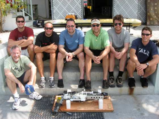
It takes a village of roboticists to run a successful AUV campaign

It takes a village of roboticists to run a successful AUV campaign

When I emailed Dr. Trembanis upon my return to Delaware, he emailed me back with instructions to browse to UNCW’s Life Support Buoy live webcam above the Aquarius Reef Base. Sure enough, he was there aboard the RV George F. Bond monitoring his Gavia Scientific AUV as it acoustically mapped the Conch Reef around the Aquarius as a precursor robotic mission for NEEMO 15.

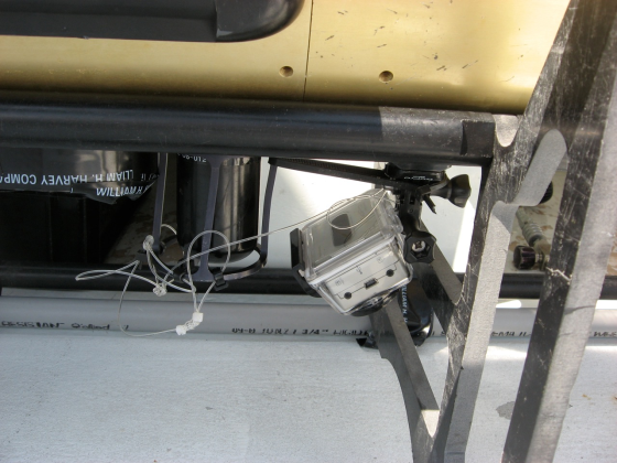
Go Pro Hero Attached to the AUV

Go Pro Hero Attached to the AUV

Here is video footage shot by an off-the-shelf HD Go Pro Hero digital video camera that was attached to the AUV:

httpv://www.youtube.com/watch?v=8n3nR9TaVGo

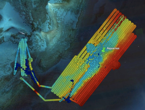
The mapping mission ran for 4 days and covered approximately 100km, resulting in about 15Gigabytes of raw data. Here’s an overview map of the mission.

Aquarius NEEMO 15 precursor survey

Aquarius NEEMO 15 precursor survey

Many thanks to Dr. Trembanis for the video and imagery to go along with the story. Be sure to visit NASA’s NEEMO site to learn more about the mission and what’s to come. Visit the CSHEL site to learn more about the research that’s going on there and to see other cool video and image products that they’re producing.

Sub-Bottom Profiling using an AUV

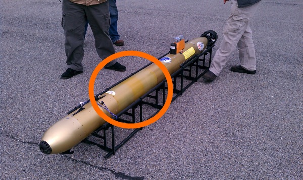
I was minding my own business, walking between Smith Lab and Cannon Lab buildings when what to my wandering eyes should appear but a reeeallly long stretched out Gavia Scientific AUV. My geek radar started going off and I just HAD to investigate exactly what was inside these newly milled sections of hull.

Gavia Scientific AUV with a recent addition

Gavia Scientific AUV with a recent addition

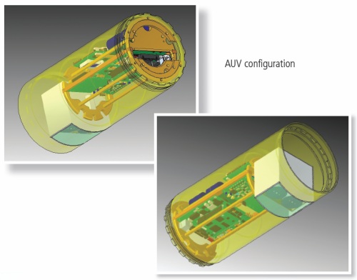
I invited myself into the lab and started asking some questions. It turns out that these new sections contain a prototype Teledyne Benthos Chirp III sub-bottom profiler that was specially designed to integrate with an AUV. Dr. Art Trembanis’ CShel lab and Val Schmidt from the University of New Hampshire’s Center for Coastal and Ocean Mapping were working with UTEC Survey Inc. to successfully integrate and test this new addition to the AUV’s sensor lineup. I cornered Nick Jarvies from UTEC and he gave me the run-down on the new addition (thanks Nick!):

httpv://www.youtube.com/watch?v=fQkWAhaFcsk

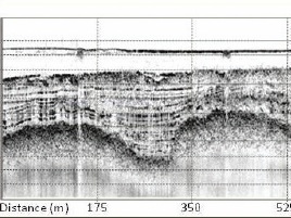
Sample SBPWhat is a “sub-bottom profiler” you ask? Per the Wikipedia entry, it is a “powerful low frequency echo-sounder…developed for providing profiles of the upper layers” of the ocean floor. In the case of the Chirp III, probably in the range of 10-20kHz. Per Dr. Trembanis “Data is stored in an onboard Compact Flash card in an industry standard SEG-Y format.  The advantage of a chirp signal over a single frequency output is that through chirp demodulation of the returning signal one can get a better compromise between penetration and resolution.  The lower the frequency the greater the penetration but the less the resolution (and vice versa for high frequency) so a chirp signal which modulates from a low to high frequency provides penetration and resolution.  All of this depends to a great degree on the kind of bottom material one is trying to penetrate.”

Internal view of the Benthos Chirp III AUV SBP

Internal view of the Benthos Chirp III AUV SBP

The advantages of an AUV-based sub-bottom profiler (also per Art Trembanis) are:

  • We remove lots of water column data that would normally be unwanted and has to be removed/ignored from the record.
  • Because we can precisely follow the terrain near the bed or hold a constant depth well below the surface we can remove/diminish effects of waves that cause a ship to bob up and down.
  • We are able to do higher resolution characterization of the subsurface in greater water depths since otherwise from a surface ship you would have to use a lower frequency system to penetrate through the water column.
  • Because of the precise navigation of the AUV we can get very tight line spacing and precision following of features (i.e. pipeline routes) which allows us to provide better data more efficiently.

Thanks to everybody for taking time to talk on camera and for answering my questions!

© 2025 Ocean Bytes Blog

Theme by Anders NorenUp ↑