Category: AUV/ROV

Conch Reef Survey for NASA’s NEEMO 15 Project

Dr. Art Trembanis’ Coastal Sediments, Hydrodynamics & Engineering Lab (CSHEL) has been pretty busy lately. Not long ago I did a post about the prototype sub-bottom profiler section that he added to his Autonomous Underwater Vehicle (AUV) (see: Sub-Bottom Profiling using an AUV). I was down at the NASATweetup for the Endeavour (STS-134) launch not long ago and I got chatting with some folks from NASA’s Open Goverment Initative about the NEEMO 15 project (NEEMO stands for “NASA Extreme Environment Mission Operations“) and we discussed UD’s involvement.

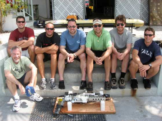
It takes a village of roboticists to run a successful AUV campaign

It takes a village of roboticists to run a successful AUV campaign

When I emailed Dr. Trembanis upon my return to Delaware, he emailed me back with instructions to browse to UNCW’s Life Support Buoy live webcam above the Aquarius Reef Base. Sure enough, he was there aboard the RV George F. Bond monitoring his Gavia Scientific AUV as it acoustically mapped the Conch Reef around the Aquarius as a precursor robotic mission for NEEMO 15.

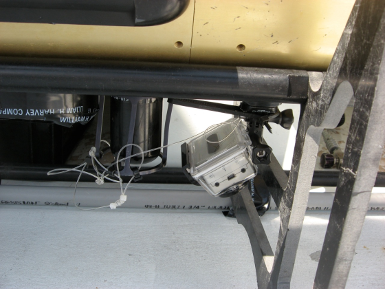
Go Pro Hero Attached to the AUV

Go Pro Hero Attached to the AUV

Here is video footage shot by an off-the-shelf HD Go Pro Hero digital video camera that was attached to the AUV:

httpv://www.youtube.com/watch?v=8n3nR9TaVGo

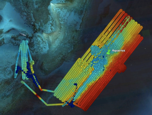
The mapping mission ran for 4 days and covered approximately 100km, resulting in about 15Gigabytes of raw data. Here’s an overview map of the mission.

Aquarius NEEMO 15 precursor survey

Aquarius NEEMO 15 precursor survey

Many thanks to Dr. Trembanis for the video and imagery to go along with the story. Be sure to visit NASA’s NEEMO site to learn more about the mission and what’s to come. Visit the CSHEL site to learn more about the research that’s going on there and to see other cool video and image products that they’re producing.

Sub-Bottom Profiling using an AUV

I was minding my own business, walking between Smith Lab and Cannon Lab buildings when what to my wandering eyes should appear but a reeeallly long stretched out Gavia Scientific AUV. My geek radar started going off and I just HAD to investigate exactly what was inside these newly milled sections of hull.

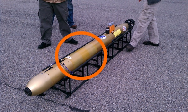
Gavia Scientific AUV with a recent addition

Gavia Scientific AUV with a recent addition

I invited myself into the lab and started asking some questions. It turns out that these new sections contain a prototype Teledyne Benthos Chirp III sub-bottom profiler that was specially designed to integrate with an AUV. Dr. Art Trembanis’ CShel lab and Val Schmidt from the University of New Hampshire’s Center for Coastal and Ocean Mapping were working with UTEC Survey Inc. to successfully integrate and test this new addition to the AUV’s sensor lineup. I cornered Nick Jarvies from UTEC and he gave me the run-down on the new addition (thanks Nick!):

httpv://www.youtube.com/watch?v=fQkWAhaFcsk

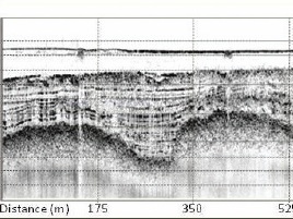
Sample SBPWhat is a “sub-bottom profiler” you ask? Per the Wikipedia entry, it is a “powerful low frequency echo-sounder…developed for providing profiles of the upper layers” of the ocean floor. In the case of the Chirp III, probably in the range of 10-20kHz. Per Dr. Trembanis “Data is stored in an onboard Compact Flash card in an industry standard SEG-Y format.  The advantage of a chirp signal over a single frequency output is that through chirp demodulation of the returning signal one can get a better compromise between penetration and resolution.  The lower the frequency the greater the penetration but the less the resolution (and vice versa for high frequency) so a chirp signal which modulates from a low to high frequency provides penetration and resolution.  All of this depends to a great degree on the kind of bottom material one is trying to penetrate.”

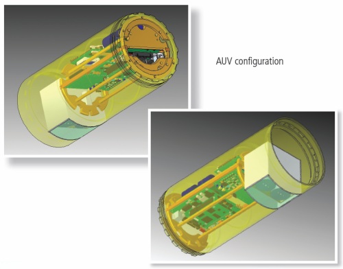
Internal view of the Benthos Chirp III AUV SBP

Internal view of the Benthos Chirp III AUV SBP

The advantages of an AUV-based sub-bottom profiler (also per Art Trembanis) are:

  • We remove lots of water column data that would normally be unwanted and has to be removed/ignored from the record.
  • Because we can precisely follow the terrain near the bed or hold a constant depth well below the surface we can remove/diminish effects of waves that cause a ship to bob up and down.
  • We are able to do higher resolution characterization of the subsurface in greater water depths since otherwise from a surface ship you would have to use a lower frequency system to penetrate through the water column.
  • Because of the precise navigation of the AUV we can get very tight line spacing and precision following of features (i.e. pipeline routes) which allows us to provide better data more efficiently.

Thanks to everybody for taking time to talk on camera and for answering my questions!

Flat Stanley Rides a REMUS in Antarctica

httpv://www.youtube.com/watch?v=09uzDjDOmjo

Flat Stanley joined researchers at Palmer Station in Antarctica in search of penguins and environmental data about their feeding grounds in January.  This video showcases just how awesome this icon of international literacy and community can be. Armed with only a minimal amount of training, Flat Stanley managed to pilot a REMUS Autonomous Underwater Vehicle in a precision pattern through the frigid waters off the West Antarctic Peninsula  — gathering vital information that will allow scientists to understand the feeding habits of Antarctic penguin species.

You can see a map about the many locations this worldly traveler has gone and find out more about the Flat Stanley Project on their website. Many thanks to student travel coordinators at Sierra Canyon School in Chatsworth, CA for helping Flat Stanley make his way this far south.

Awesome job Stanley!

Trip to Penguin Colony on Biscoe Point

Folks seem to like penguins….so much so that we even made the front page of the University of Delaware website! Hurray! This shot is of the Adélie penguin colony on Humble Island. We had just deployed a satellite transmitter on one of the birds so we would know where to send the underwater robots (Gliders and REMUS’s).
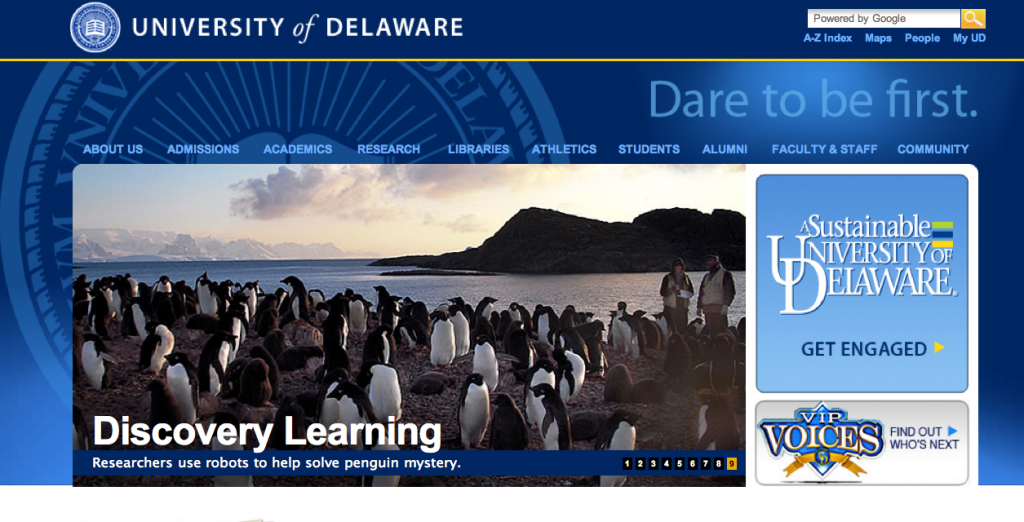
University of Delaware Main Page

Remnants of the storm remain in the area and wind gusts are keeping the science boats at station today. Nevertheless, we did have a break in the clouds and the sun came out. The warm sun made the Gamage glacier very active and I happened to get a great video of calving. Right place, right time.

httpv://www.youtube.com/watch?v=vANNYwc2d_k

We headed out to Biscoe Point to deploy another satellite transmitter on a penguin. The plan was remove the transmitter from a Gentoo penguin which had been at Biscoe Point since mid-night. The challenge is to find the tagged bird amongst the rest! On the way, a large amount of brash ice had surrounded Biscoe Point, so we had 1-2km if slow travel through the ice. Marc Travers (our boat driver and expert birder) did an excellent job snaking in between the large chunks. Outboard motors and large chunks of brash ice don’t mix well. Hitting a large piece of ice can leave you on a boat with a busted motor. That is why we carry an extra motor in every boat.

httpv://www.youtube.com/watch?v=URLwiXtnZk0

When we arrived at Biscoe Pt. we found that an Elephant Seal had climbed into one of the Gentoo Penguin nesting areas. If the penguin chicks are too young or unguarded by its parents, they can be easily crushed by these massive seals.
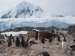
Southern Elephant Seal in Gentoo Penguin Colony overshadowed by Mt. William

Luckily it looked like the Gentoo chicks were old enough to avoid it. Occasionally a Gentoo adult would peck at the Elephant Seal’s thick blubber, but the giant beast didn’t seem to be bothered by it at all.  We made our way around the Gentoo colony looking for our tagged bird. She happened to be perched right on a rock preening herself where we could see her plain as day. The birders quickly removed the tag and she went back to her nest.
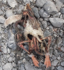
Penguin Chick Eaten by Skua Birds

Elephant Seals aside, the biggest threat to the chicks are Skua’s. These are aggressive scavenger birds swoop down and grab chicks right from their nests and make a meal out of them. There was plenty of evidence at Biscoe Pt. that the Skua birds had been active here.

Still, even with the ever present Skua, there were plenty of Gentoo chicks that were starting to look more and more like their parents. They are are starting to get their adult feathers. Their feathers are not waterproof yet, but they will be soon.
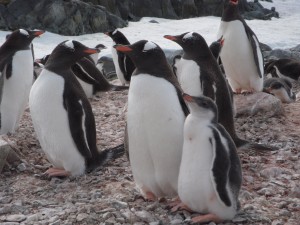
Gentoo Chick with Parent at Biscoe Pt.

The next step was downloading the dive information from the tag. This data will help us understand how deep the penguins are feeding. The dive data will help us properly analyze the data coming from the underwater Gliders and REMUS vehicles. The Birders are able to download and ready the tag for its next deployment in just a few minutes with a laptop computer in the field. These are amazing little tags.

httpv://www.youtube.com/watch?v=v-lLPVhjnMY

We walked around a small bay to the neighboring Adélie Penguin colony and were able to quickly identify an Adélie penguin that would be good for carrying our satellite

Adélie Penguin packed with a satellite transmitter.

transmitter. She was quickly tagged and released back to her nest. Her two grey puffy  chicks are just to her right. We will be watching the satellite data closely to find out where she is eating. Then, we will send our underwater robots to sample that section of ocean.  In a few days the Birders will head to Biscoe Pt. again to retrieve the tag, and thank her for her contribution to science.

Antarctic Storm Moves In

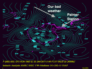
Our streak of excellent weather has officially come to an end with a large low pressure system in the Drake Passage.

Storm moves into Palmer Station

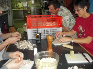
The weather was even tough tough for the ever-working “birders” who were going to deploy a few satellite tags on penguins today. REMUS missions are cancelled for the day. That might be good since one sprung a leak on a mission yesterday. Only the gliders are out….which makes gliders an awesome platform for ocean science when the weather gets a bit “snotty”. They don’t complain and don’t get sea-sick. The “Blue-Hen” continues is mission mapping the foraging locations of penguins when even the penguins are too scared to go out! That means I get to stay home and peel garlic (very necessary for all the amazing food here).

Garlic….it’s like the best thing you can eat when it is windy

Saturday is also the day we all clean the station and have a station meeting. I got to help clean the kitchen today. That was really nice because I totally miss cleaning the kitchen at home (no, not really). We also learned that hiking on the Gamage glacier behind the station is more restricted after a new crevasse opened up. Funny story about that…..Mark Moline found it by falling into the crack. He was fine, but it was a bit un-nerving. The GSAR (Glacial Search and Rescue) team changed the boundaries after they went and uncovered the full extent of “Mark’s Crack”.

The bad weather lets us do a bit of data analysis on where the penguins are foraging. The penguins seem to be keying off of the deep canyon off of Palmer station. This has been a working hypothesis from the “birders”

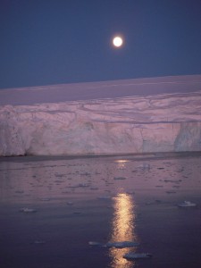
Finally, I’ll leave you with an awesome moon-rise over the Gamage Glacier. Pretty awesome sight.

Moonrise over Gamage Glacier

Penguins, AUV’s, Satellites: together at last

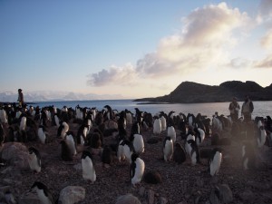
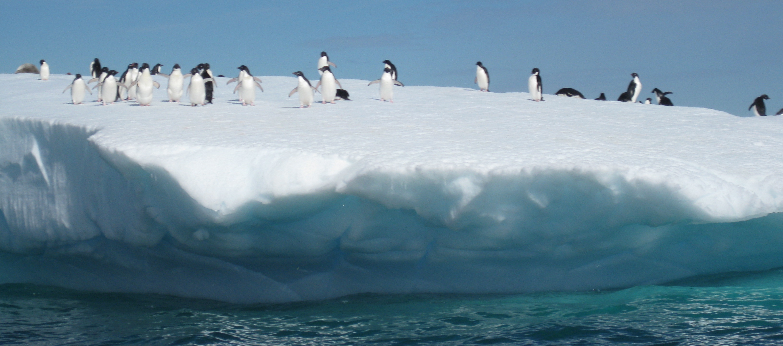
Adélie Penguin Rookery

Adélie Penguin Rookery on Humble Island

Satellite tagged Adelie Penguin

Satellite tagged Adelie Penguin

Penguin swimming tracks near Palmer Station

Penguin swimming tracks near Palmer Station

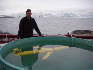
Ballasting the Glider (Blue Hen)

Ballasting the Glider (Blue Hen)

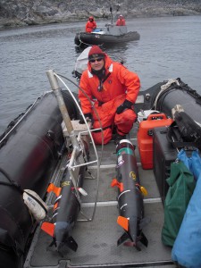
Is it possible to follow penguins from space to understand where and how they are feeding in Antarctica? Absolutely!..but not without an excellent team from University of Delaware, Rutgers University, Polar Oceans Research Group, and Cal Poly San Luis Obispo. The sequence starts with the “Birders”. The “Birders” are from Polar Ocean Research and they have been studying penguins in the West Antarctic Peninsula for years. The “Birders”, headed by Bill and Donna Fraser, head out to local rookeries to identify good penguins to tag with satellite transmitters. Finding the right breeding pair is key. The pair should have two chicks with both parents still around. Some chicks only have one parent, probably because one parent was killed by a Leopard Seal. We want to choose one of the parents, because we are pretty certain they will return to their chicks to feed them. This also helps in recovering the transmitter. If the bird does not return, the transmitter comes off during their natural annual molt cycle. Once a penguin is selected, it is gently fitted with a satellite transmitter. Special waterproof tape is used to connect the transmitter to the thick feathers on the back of the penguin. The penguins are remarkably calm during the process.  Once the tag is attached, the penguin is released back to its nest. The next part of the sequence is for the birds. The penguins head out to feed on krill and small fish in the area. Their tags relay their position information to ARGOS satellites and we get nightly updates. The Birders pass on their data to me nightly, and I filter and map the penguin tracks. I put them into Google Earth, so we can see where the penguins have been feeding. Then, through the magic of mathematics, we turn their tracks into predicted penguin densities. Based on these densities, we plan our AUV missions to intersect with the feeding penguins (Slocum Electric Gliders and REMUS AUV’s).  The first priority is to make sure the AUV’s are ballasted correctly. This means that they need to be trimmed with weights just right so they travel correctly under the water. We use small balances and scales to get the weight of the vehicle just right, then put them into ballasting tanks to make sure we did it correctly. The vehicles should hold steady just under the surface of the water.

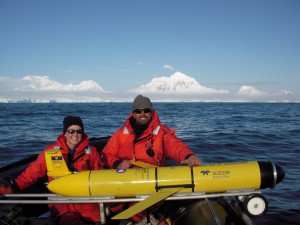
Getting ready for the launch of the "Blue Hen"

Getting ready for the launch of the "Blue Hen" (M. Oliver and K. Coleman)

Once we have a planned mission, we head out in small zodiacs from the station to a pre-determined point. For the Gliders, we call mission control at Rutgers University (Dave, Chip, John) and let them know a glider will be in the water shortly. Once it is in, control of the glider is accomplished via satellite telephone directly to the glider. The glider calls in and reports data and position to mission control. We can see the data coming in live over the web, and in Google Earth as we navigate the vehicle to where the penguins are feeding. The gliders move by changing their ballast, which allows them to glide up and down in the water while their wings give them forward momentum. They “fly” about 0.5mph for weeks at a time!

Mark Moline with REMUS's

Mark Moline with REMUS's

In contrast to the Gliders, the REMUS vehicles are very fast and are designed for shorter, 1 day missions. Daily missions are planned around the penguin foraging locations. The Cal Poly Group (Mark Moline and Ian Robbins) have been launching 2 Remus Vehicles per day to map areas the gliders can’t get too. Like the gliders, these vehicles call back via iridium to let us know how they are doing in their mission.

MODIS Chlorophyll, Penguins, and Gliders

Glider Dances around Adélie Penguin Tracks in a sea of chlorophyll

Finally, we are getting satellite support from my lab at U.D. Erick, Megan and Danielle have been processing temperature and chlorophyll maps in near-real time to support our sampling efforts, as well as AUV operations up and down the West Antarctic Peninsula. Just today, we saw that the penguins in Avian Island (south by a few hundred miles) have been keying off of a chlorophyll front. RU05 was deployed by the L. M. Gould and will be recovered soon. All in all, it is a pretty awesome mission to track these penguins from space and AUV’s. We will see how the season develops!

Note: I will be uploading photos and videos to the ORB Lab Facebook page throughout my stay in Antarctica. Be sure to check there for my latest updates.

Penguins from Space


The West Antarctic Peninsula (WAP) is one of the most rapidly warming regions on Earth, with a 6°C temperature rise since 1950.  Glaciers are retreating and the duration and extent of sea ice has significantly decreased. Many species rely on the sea ice as a resting platform, breeding ground, protective barrier or have life histories linked to sea ice thaw and melt cycles. With the declines in sea ice, many species are having a difficult time surviving and adapting to the new warming conditions.

The food web along the WAP is short and allows energy to be transferred efficiently. Phytoplankton (tiny plants that capture energy from the sun) are ingested by zooplankton (such as krill) which are in turn eaten by penguins, seals and whales. Due to the rapid nature of the warming around Palmer Station and the short food chain, it is an ideal location to study the effects of the acute changes in a warming environment.

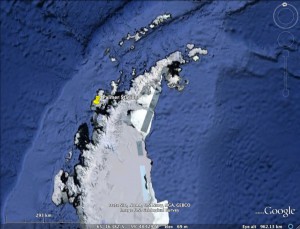
Palmer Station, Antarctica

In particular, Adélie penguins are experiencing significant population declines near Palmer Station, Antarctica.  On Anvers Island, populations have decreased by 70%. Declines in sea ice have also led to declines in the preferred food of Adélies.  Silverfish have nearly disappeared and krill have decreased by 80%. Currently, Adélies are having a difficult time finding a satisfying meal. In turn, many species are migrating southward to look for new places to live and better food resources. On the other hand, ice-avoiding species (Gentoo and Chinstrap penguins) have been able to move south into the Adélies home range.

Adélies are a prime vertebrate species to study in relation to a changing environment.  Tagging Adélies in summer breeding colonies with satellite-linked transmitters, allow foraging locations to be monitored. Their foraging tracks can be compared to satellite derived oceanic properties such as sea surface temperature, chlorophyll, sea-ice, and wind. Since conditions have changed so quickly over the last few decades, the recent development of satellites can easily detect these changes. The UD-134 Slocum Glider (underwater robot) will be deployed in January 2011 and 2012, to do additional surveys near breeding hotspots.  This will allow us to combine satellite data with high resolution in-situ glider data to predict how ideal foraging locations for Adélies may change as warming continues. This will also test the satellites ability to accurately describe ecological changes that are occurring along the WAP.

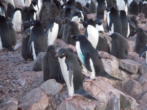
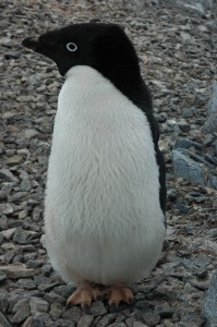
Adélie Penguin

The Palmer Long Term Ecological Research Program (PAL LTER) began in 1990, and investigates aspects of this polar environment while maintaining historical records for marine species.  Historical satellite data and species records will be useful in predicting phytoplankton, krill and penguin abundances and distributions.  Models will be used to predict future foraging locations of Adélies in PAL LTER region of the WAP. It is important to study this region because changes are happening faster than predicted and these changes can lead to dramatic effects in our lifetimes.

Wicked Cool Slocum Electric Glider 101

Last week we had just received the UD-134 glider (aka the “Blue Hen”) from two tours of duty in the Gulf of Mexico in collaboration with IOOS and Rutgers University for the Deepwater Horizon Oil Spill Response project.  To prepare for an upcoming Antarctic mission, we needed to get some work done on UD-134 at the source – Teledyne Webb Research in Massachusetts. Since we were only five hours south of Webb at the time, I loaded the Zune HD (with purely educational podcasts of course – in this case Security Now) and it was road-trip time for me and two of the students from the ORB lab.

The students who went with were really excited to get to learn from the masters while we tore down UD-134 at Rutgers. (For those new to gliders, Rutgers is the undisputed kings of the glider realm, they’ve been flying them since, like forever). One of the students who came with was a summer intern who was charged with learning how to pilot the Glider over the summer. Because of the last-minute deployment of UD-134 in the Gulf, he had lots of pilotting time on a simulator, but not so much hands-on with real Gliders. The other student was a new grad student who would be responsible for ingesting and processing glider data, so she was looking forward to the trip as well.  When we decided at the last minute to head up to Webb Research to deliver the components, the intern said he “felt like Willie Wonka with the winning ticket to tour the chocolate factory”. He was definitely not disappointed as Peter Collins met us at the doors of Webb and gave the students and I the grand tour.

Peter Collins (aka “Texas Pete” for this post) donned his cowboy hard hat and headed to the ballast tank with me and a couple of our students last week to do a quick talk for Ocean Bytes.  Pete gave a quick introduction to the Slocum Electric Glider – an Autonomous Underwater Vehicle (AUV) or Underwater Glider that is made by Teledyne Webb Research. Take note that the glider that Pete has in front of him as it is a tad different from most in that it has two science bays (there is usually only one). This one is being fitted with a Photosynthetically Active Radiation (PAR) sensor and a FIRe sensor  (remember Lauren’s video?) from Satlantic. I’ll hand you to Peter now so he can discuss what a glider is for and how it works…

In addition to the lineup of first generation gliders, we were introduced to the second generation gliders that are just now being manufactured – also called the “G2” gliders.  I’ll try to cover everything that we learned about the G2 systems in a future post.

Thanks again Peter for the awesome hospitality and for taking such great care of us!

Note: Getting lots of inquiries as to where one might obtain “Cowboy Hard Hats” – Peter provided a couple of links to possible suppliers – Link 1 and Link 2.

Hydronalix Autonomous Science & Security Boat (HASS)

While I was at the BEST workshop, I had an opportunity to talk with Tony about H.A.S.S. – the Hydronalix Autonomous Science & Security Boat. You may have heard of the Hydronalix for another product that Popular Science did a write-up on recently – E.M.I.L.Y. – which stands for “EMergency Integrated Lifesaving lanYard” (see Robo-Baywatch article).

HASS is a small hydro-jet powered boat a tad over 4 feet long. Its claim to fame is that it has the ability to approach marine mammals at a much closer proximity than is allowed via standard surface ships and that it will have much less of an impact with its presence due to its small size and electric drive. I shot a video with Tony (my apologies for the poor sound quality – lots of background noise).


HASS has an impressive list of features and capabilities which include:

  • Hydro-jet powered to prevent damage to marine animals from a propeller
  • Remotely Operated Camera
  • Side-scanning Sonar
  • Electric powered (batteries can be changed in ~5 minutes)
  • Up to 40 mph speed, with 20-30 typical
  • Endurance from 2-7 hours depending on operating conditions
  • Wireless control via a nearby ship (~0.5 mile range) or support for control via iridium satellite phone

Doug

BEST: YSI EcoMapper AUV

As promised, I’m starting to weed my way through a couple of the videos that I shot at the BEST Workshop in Oxford MD (see previous post).  My apologies for the poor sound quality – we had a ton of people on the back deck, which created a lot of background noise. Not bad considering I shot it with my cheapy $120 HD video camera though.

This is a recording of a discussion that I had with Chris from YSI about their EcoMapper AUV. It appears that YSI has taken the OceanServer AUV and loaded it with an impressive array of sensor technologies.  The system runs Windows XP embedded on the AUV and it simply appears as another computer on the network when you’re interacting with it via wireless communications.  I’ll shut up now and let Chris do the talking, he’s the expert.

Enjoy!

Bay & Estuarine Sensor Technologies (BEST) Workshop

I was able to attend the 2010 Bay & Estuarine Technologies Workshop (BEST) last week. It was held July 27-30 at the Environmental Science & Training Center at COL in Oxford, MD. Also called the “BEST by the Bay” workshop, this years workshop is a follow-up  to last years “AUVs in the Bay I” which was held in June of 2009.

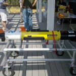
AUV on Display at BEST

AUV on Display at BEST

I am a first-time attendee and it was well worth the trip. There were some awesome technologies on display at the center, including Buoys, Autonomous Underwater Vehicles (AUVs), Unmanned Surface Vehicles and other technologies that allow for limited human interaction in the collection of water quality data in remote regions of the bays and estuaries. The workshop focused on “the application of sensors used in estuarine systems and storing the data using IOOS protocols so it can be used in environmental forecasting models, such as hypoxia”.

I was only able to attend the Wednesday portion of the program, so I’ll only write about what I saw. After walking around and drooling on many of the AUVs and ROVs on display (lucky they are all watertight) we went around the room and introduced ourselves and the meeting started. 

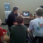
Kids Learning from Art Trembanis

Kids Learning from Art Trembanis

Attendees included a wide gambit of technology vendors, managers, scientists and even educators, students and boy scouts. The head honcho Doug Levin of NOAA quickly took charge and got all of the AUV operators who were going to run a mission on task to program their AUVs for the task at hand. In addition to the science mission, the day also included a keynote and several other presentations throughout the afternoon.

I took a few minutes and recorded a few Question & Answer sessions with some of the attendees.  I hope to cobble those together and get them online sometime soon.

© 2024 Ocean Bytes Blog

Theme by Anders NorenUp ↑