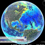
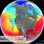
As a new grad student in the ORB (Ocean exploration, Remote Sensing, and Biogeography) lab at the University of Delaware under Dr. Matthew Oliver, I (along with my cohort Danielle Haulsee) were tasked with learning to write code in R. R is a language that enables statistical computing and making graphical displays. To some of you this may sound basic, but having no prior programming experience it was a little overwhelming at times. After getting the basics down, we then started pulling sea surface temperature and chlorophyll data from NASA’s Goddard Space Flight Center (GSFC) MODIS Aqua satellite. This isn’t just any temperature and chlorophyll data either, it’s real-time and updated everyday! From this we were able to create maps on Google Earth, which is a great platform for viewing and interacting with multiple data layers on a global scale. This allows us to easily distribute NASA’s data for ocean planning. These overlays along with others were also able to assist in planning Slocum Glider missions in areas surrounding the Gulf oil spill.
In our Google Earth maps, we created 1, 3, and 8 day averages that reflect the current conditions in the ocean. Each day our code downloads the lastest satellite data that has been updated on NASA’s website and then it is averaged along with the previous days to create an average. The 1 day average maps are patchy due to the fact that the satellites can not see through the clouds. Therefore, the 8 day averages make for a more complete and accurate picture. For higher resolution images, we created smaller maps of just California, the East Coast and even Antarctica! These locations correspond to areas that we conduct further research in. Google Earth was interested in our overlays so check out the Google Earth Gallery for sea surface temperature and chlorophyll concentrations near you!


August 23, 2010 at 10:26 pm
I’m blown away by your mad skillz
December 22, 2010 at 8:02 am
Wow, this is awesome. Solid work Megan
January 7, 2011 at 7:01 am
Fantastic job Megan. Something I will use everyday to help my science!!